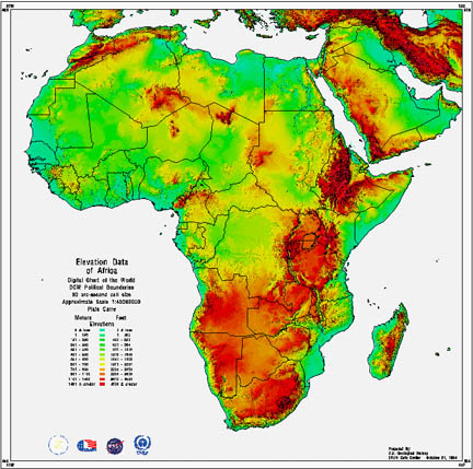
Similar to topographic maps, these also represent the rise and fall in elevations across a region. The maps differ though because instead of contour lines, hypsometric maps utilize color and shding to convey the information. This process makes the images more visually stimulating than their lined counterparts.
http://junglephotos.com/africa/afmaps/afscimaps/africaelevationmap.shtml
No comments:
Post a Comment